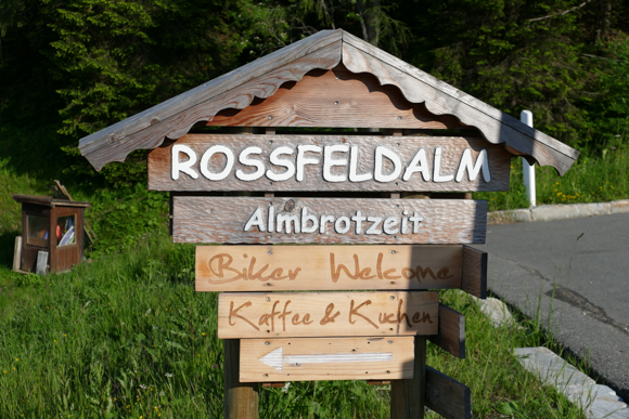
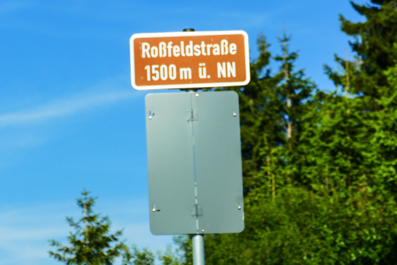
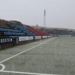
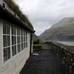
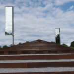
There are just a couple of toll roads in Germany (if you neglect road toll for trucks). One of them is the B999 in very Southeast Germany in the Berchtesgadener Land area, which is typically refered to as Roßfeldpanoramastraße (“Rossfeld Panoramic Route”) or Roßfeldhöhenringstraße (“Rossfeld Mountain Ring Road”). During my stay in the area, I had at least a short evening view of this beautiful road, which even touches Austria for some 1.5 kilometers. With a total length of 15.4 kilometers, it is the longest toll road in Germany as well. I decided to present you this beauty as a Pictured Story with less text and major pictures.
Rossfeld Panoramic Route – History & Location
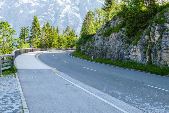
Together the public B319, the Rossfeld Panoramic Route is a ring road which you can drive in both directions. Its original planning has been done by the Nazis, who started building this project in 1938 in order to create a final highlight of the Deutsche Alpenstraße (German Alpine Road), a recreational route along the Northern part of the German Alps (it is nowadays not included to that route, though). There are numerous memories of the Nazi Germany times around, the most prominent one, Hitler’s former holiday house Berghof at the Obersalzberg, which is located close to the Southern exit of the Rossfeld Route, and the Kehlsteinhaus. The closest city is Berchtesgaden.
Rossfeld Panoramic Route – Toll & Services
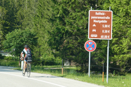
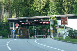
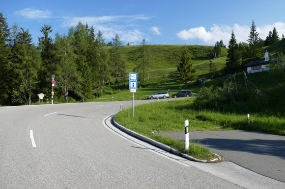
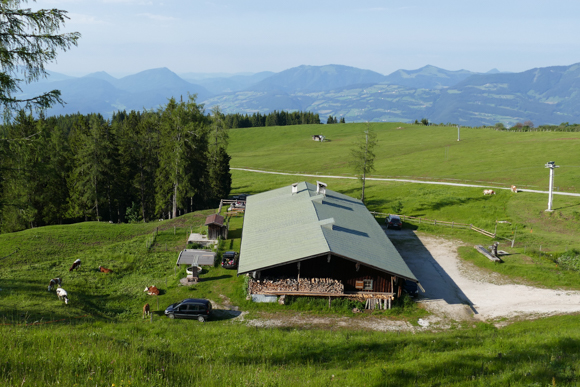
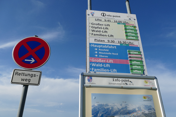
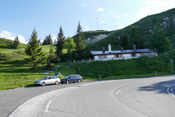
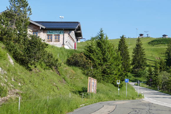
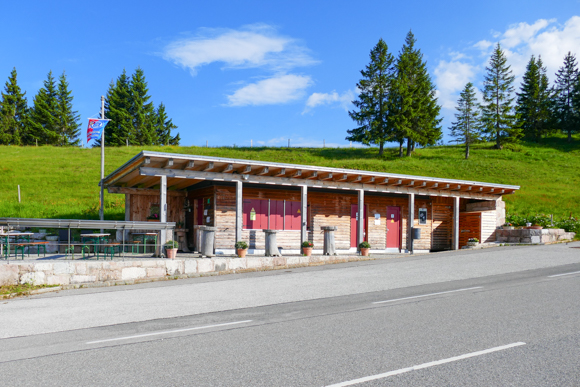
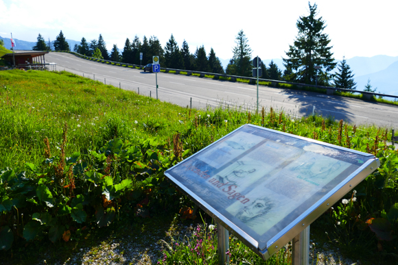
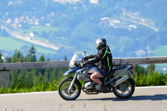
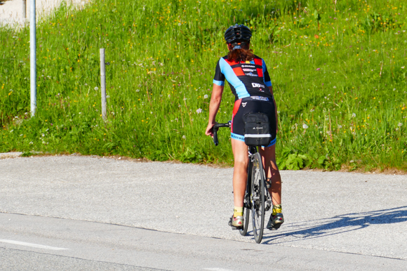
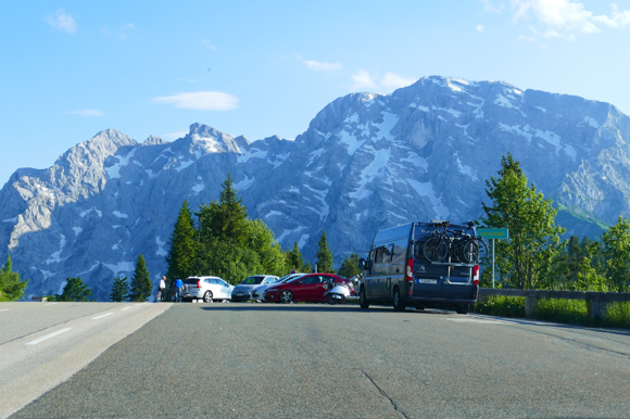
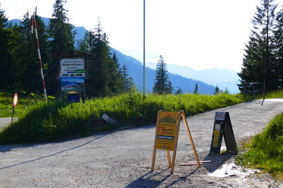
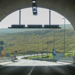
There are toll booths on both ends of the route. The one-way road toll is 8.50 EUR for a car currently (motorbikes: 5 Euro). The route is also very popular among cyclists. There are sets of ten tickets, which you can only buy at the Northern toll booth. All tickets include any passengers.Close to the highest point of the route, there is a restaurant and a snack bar, which also features a public toilet. Most people do not only travel the route by car, but use it for hiking. There are parking lots all around the rote.

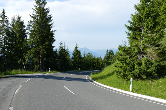
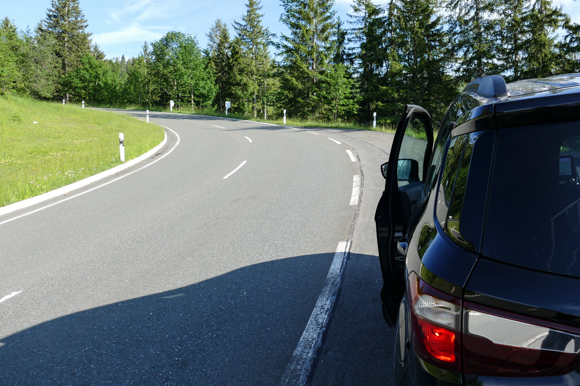
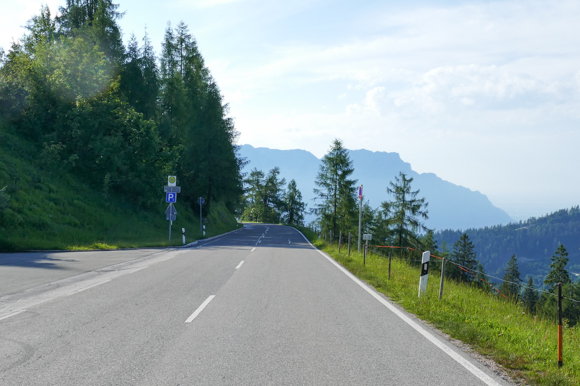
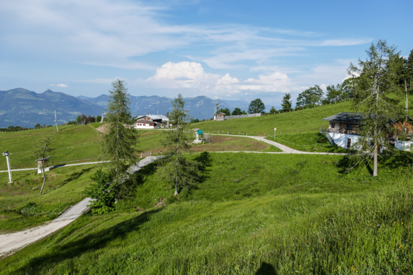
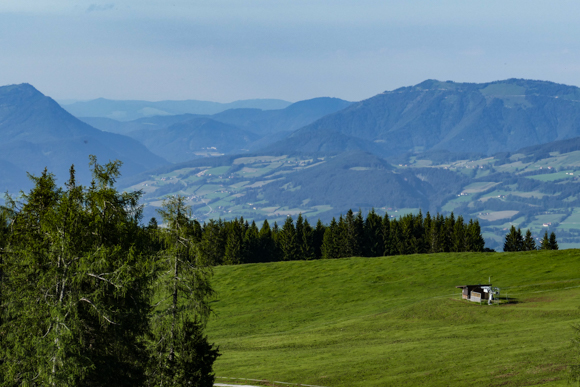
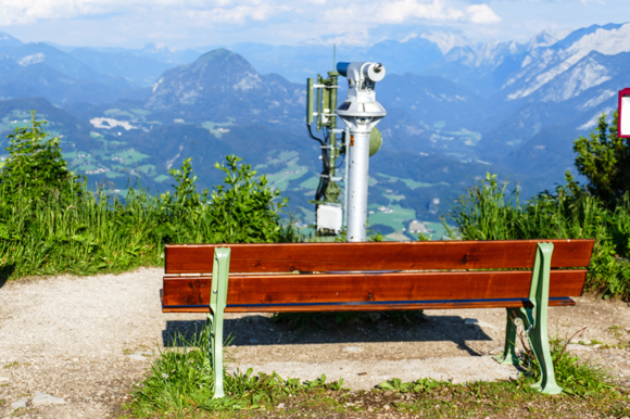
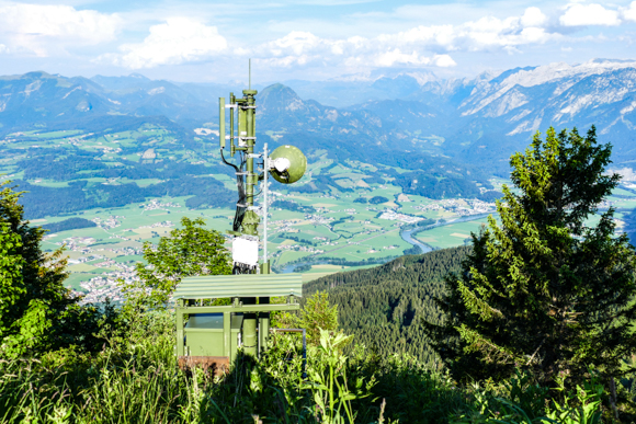
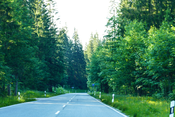
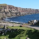
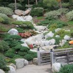
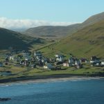
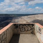
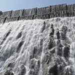
Rossfeld Panoramic Route – Impressions
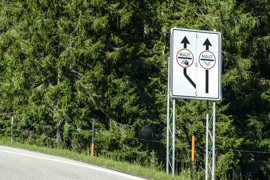
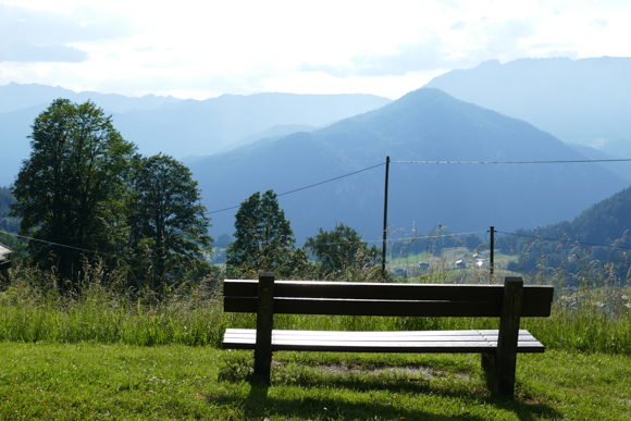
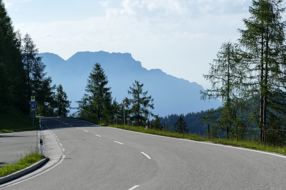
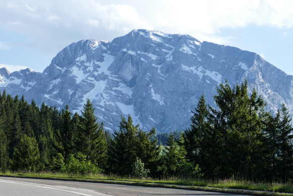
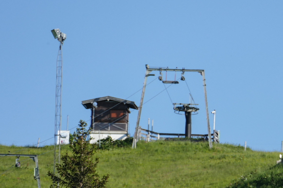
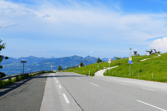
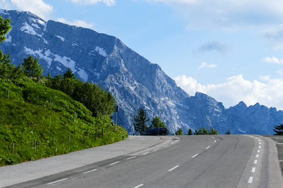
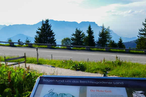
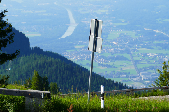
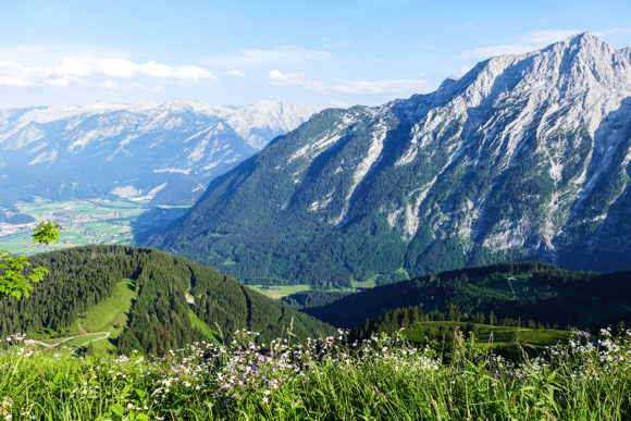
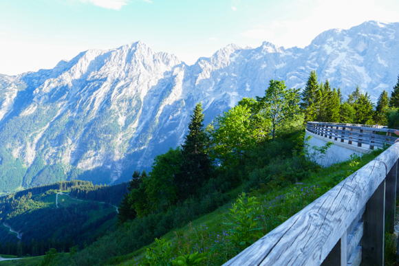
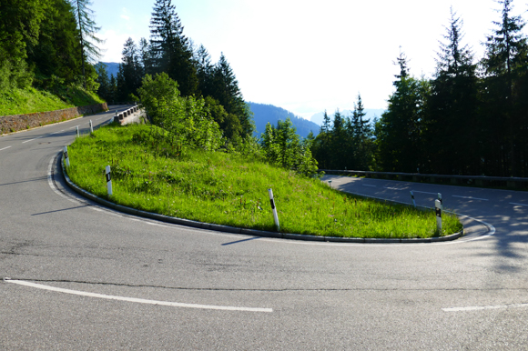
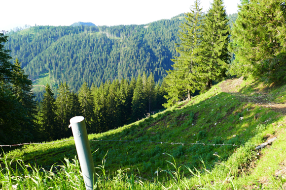
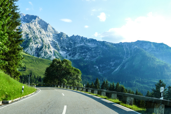
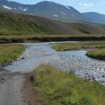
I did the Rossfeld Panoramic Route from North to South (B to A on the map above), which I feel is slightly nicer – majorly, because the Northern uphill part is more fascinating and has some lovely views, before you finally reach the highest point of the route, which is 1570m above sea level. With that, the Rossfeld Panoramic Route is Germany’s highest road, which is not dead end. After you reach the peak of the road (from the North side), you also touch Austrian ground, as mentioned above. Most of the views you have from the several viewpoints are facing towards the Austrian Alps.
Flyctory in Salzburg & Berchtesgadener Land
All my postings related to the German – Austrian region of Salzburg & Berchtesgadener Land:
I always enjoy running into artists I haven't covered before. Quite long before the album release of Sunflowers, I found the ...
My list of new song releases is really short this week again. There were not that few new releases, but ...
Especially after I reviewed the amazing album Das ist keine Übung in October 2023, I was really looking forward to see Alex ...
In 2021, I introduced you to Alex Diehl the first time. That year, he released the amazing EP Die Songs, die ...
It is just mid-year 2023 and I already start working on my 2024 Rock of Ages International Tour list. I am sure ...
After some rather intense week of traveling, I feel rather happy to spend the next two weekends in and around ...
A lot of Christmas songs, a lot of covers and best of albums are the new releases in the - ...
After a flight reschudling in summer 2021, my wife and I needed an additional night in Austria before heading to ...
Powerful party tunes which are made to be great on stage: five years after their first release, the Bavarian band ...
Siegsdorf between Rosenheim and Salzburg in Bavaria might be a rather typical spot for that region: a rather nice city, ...
Not really sure why the release calendars are so seasonal (apart from major holidays like Christmas) - but I generally ...
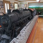
The Lokwelt Freilassing is one of the most famous train museums in Germany. During a trip through Bavaria, I had ...
In late August 2021, I flew back from Salzburg Airport (SZG) to Dusseldorf Airport (DUS) with Eurowings. My BizClass ticket ...
I had a couple of trips to Salzburg and neighboring areas in recent past. While some have been rail trip, ...
The press kit to this EP opens with "Another singer-songwriter who is writing about his personal lovesickness. Does the world ...
I really enjoy being in Salzburg as a recreational destination - now I am having a look at the Austrian ...
For a weekend trip to Tyrol, my wife and I flew to Salzburg Airport (SZG) and took a rental car ...
Twelve cover songs of German music legends - when I recently reviewed a similar concept, #Schlager by Stereoact, my rather was ...
Even though I am not a beer drinker, I made a brewery tour during my last stay in the Salzburg ...
After my visit of the Panorama Mesdag in The Hague / Den Haag, Netherlands, I just had to visit the ...
The Berchtesgadener Land is not only nowadays well-known as a popular tourist destination, there is also a dark part of ...
After praising my favorite songs of 2020 and the favorite albums and EPs in 2020, the final posting to do ...
I arrived in Salzburg late before I had the Alpen-Sylt-Express night train ride from Salzburg to Sylt the day after ...
One thousand kilometres to the sea - or vice versa One thousand kilometres to the Alps - was the slogan a new private ...
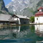
The Königssee (literally: "King's Lake") is a beautiful lake in Southeastern Bavaria, not too far away from the Austrian border ...
Hangar 7 at Salzburg Airport, driven by (likely) the world leader of energy drinks, is a quite popular and well ...
For my June 2020 stay in the Salzburger Land / Berchtesgadener Land area, I decided to go for two nights ...
Whenever you happened to watch Bobsleigh races in TV, did you also often think about how it is like to ...
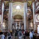
Flyctory.com Pictured Stories
The key contents of Flyctory.com Pictured Stories are the picture, not the text:
Stefani Joanne Angelina Germanotta is one of the biggest and most famous pop artists nowadays. In case you don't know ...
In my concert report, I already shared my thoughts and impression about Weird Al Yankovic's performance in Alpharetta on 31st ...
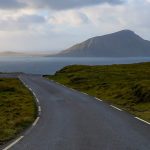
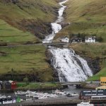
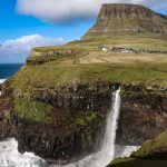
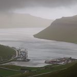
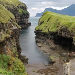
There are so many lovely spots on the Faroe Islands. Especially if you have sunny weather, the scenery is close ...
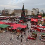
My thoughts about the World of Coca Cola in Atlanta has been one of the first posts I shared on ...
Bad luck turning into good luck: the closure of Keflavik Airport (KEF) and a corresponding flight rebooking opened the opportunity ...
A key mission of traveling to Nashville in late March / early April 2026 was to introduce my wife to ...
In 2025, I introduced concert reports in the Looking back to... format. In contrast to my ordinary concert reports, I have visited ...
Nowadays, every major city feels having one or many viewing decks or platform allowing to overlook the neighborhood - or ...
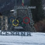
Broken down ruins or active sports venues? I asked this question twice already, visiting former Olympic Games sites. In 2018, ...
After I reduced my coverage of the Country To Country Festival in Berlin from seven posts of the 2025 festival ...
February 2026 will feature quite a lot of sports events. Apart from the Women Under 19 World Floorball Championship Qualification ...
Muli is a village in the Northern parts of the Faroe Islands. There is historic proof that the place hosted ...
Staying in the Comfort Hotel Grand Central right inside the terminal building meant that I spent quite a lot of ...
Oslo in January 2026 - I will remember these days in Norway with a big smile for a long time ...
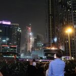
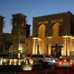
During our stay in Dubai, my wife stayed during the New Year's Eve 2024 celebrations at the Hilton Dubai Al ...
I felt that I should share some more Christmas-related contents during that time of the year. Just having visited Las ...
The Breidamerkurjökull Glacier in the Southeast of Iceland forms the Jokulsarlon, a Glacier Lagoon. The major and smaller iceberg being ...
The Faroe Islands - a place I more and more love as a place to relax and be grounded by ...
In December 2024, my wife and I stayed had two nights at the Conrad Dubai. The Christmas decoration was lovely ...
Whenever the NHL Global Series, it is not just about one or two ice hockey games. It is a meeting ...
In April 2025, I already introduced you to Motorworld Cologne. Their outlet in my home town comes with special features ...
The Faroe Islands are not only the islands of beautiful nature and countless sheep, but also a territory full of ...
A railroad museum with good reviews, even though I could hardly find any good information on the internet? The Southern ...
As I got that many pictures and material from the Rock meets Country 2025 in Sempach, I need to gain ...
The Faroe Islands have won my heart in recent years. Thus, I want to share you some impressions from there ...
Already on the second day of my Six US States and Nashville trip in June 2025, I headed to Franklin, South of ...
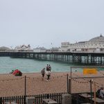
On a sunny day in summer, British people, especially from London, storm into Brighton. The coastal town is known for ...
In contrast to my 2024 coverage, I dedicate an explicit post to the atmosphere at the Sound of Nashville Open ...
I was really amazed by my trip to Andorra. The country in the Pyrenees between France and Spain is just ...
When I visited Atlanta in 2018, I wrote a post Atlanta 1996 - 22 years later, visiting former sites of the ...
Hello Kitty, Cinnamoroll, Pompompurin - all these characters by the Japanese company Sanrio conquered the world. Especially Hello Kitty is ...
After I introduced you to Puddles Pity Party in my first Looking back to... posting from Weird Al Yankovic's Bigger & Weirder Tour ...
In the mid of June, on 20th and 21st June 2025. I visited the Weird Al Yankovic Bigger & Weirder Tour 2025 ...
It was a rather quiet and rather early Sunday morning on the tenth day of my Six US States and Nashville ...
At first sight, Corbin in Kentucky looks like a nice, rather small 9,000 people town. However, there are some hidden ...
Many of my trips to Copenhagen Airport (CPH) end up in an Öresundstag trip to Sweden and a night in ...
During my visits to the Faroe Islands, I have been to several of the rather remote villages. In this posting ...
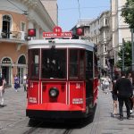
A late May 2025 trip gave me at least a short opportunity to explore the Turkish city Istanbul. I felt ...
Immersive arts exhibitions are becoming more and more popular. I introduced you to the ARTE Museum in Dubai or the ...
In 1974, the former church St Mark's on North Audley Street in London has been deconsecrated. Nowadays, the centrally located place becomes ...
As much as Lordi is the band I featured the most in my album reviews, Miniatur Wunderland is taking some ...
The musical Rock of Ages brought me to multiple places in the United Kingdom. Quite many of them wouldn't have been in ...
One of the most iconic buildings in the Faroese capital Torshavn is indeed the Torshavn Cathedral. Named Havnar Kirkja ("Harbor ...
The Sadoyartunnilin (Sandoy Tunnel) offers much more efficient and faster travel to Sandoy in the South of the Faroe Islands. Thus, ...
Watching a friend's musical performance there brought me to Bad Säckingen in Southern Germany at the beginning of January 2025 ...
Dubrovik in Southern Croatia is one of the key touristic cities at the Adriatic Sea. It also became extremely popular ...
In 2022, Dubai has opened a new educational facility. The Mohammed bin Rashid Library has become one of the most ...
Balboa Park in San Diego has so many different museums and attractions in Stock. I already took you to the ...
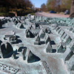
I simply love the Miniatur Wunderland. You can hardly challenge that the scale model landscape and rail attraction is the ...
It is quite exactly one year ago since my wife and I visited San Diego for the second time. The ...
During the last twelve months, the Northern French city of Lille absolutely won my heart. Starting with the UEFA Conference ...
On a road trip through Italy in 2021, I ran into a song, which made me fall in love with ...
On a Sunday in mid-August 2024, I visited the Autostadt ("Car City" or "Motor City"). Located in Wolfsburg in Germany, ...
Spending some time in and around Munich Airport (MUC), I also took the opportunity to have their Airport-Live-Tour, the basic bus tour ...
The Faroese people call Skansin (liternally: the "redoubt") the most peaceful fort on Earth. In fact, the facility built in 1580 in ...
On my multi-stop drip from Germany to Jakarta in Indonesia, I had one free day on the outbound leg in ...
Recently, I fixed another trip to Las Vegas. Weird Al Yankovic will play multiple shows at the Venetian Theater in ...
The rather recently opened Sandoyartunnilin (Sandoy Tunnel) allowed me to travel to the Southern island of the Faroe Islands for ...
What's a good way to explore the permanent fun fair and entertainment area in Vienna, the Prater, if you are ...
When it comes to spectacular views over Paris, you typically think of Tour Montparnasse or the Eiffel Tower. However, the ...
On 21st December 2023, travel and commuting in the Faroe Islands reached another evolution. On that day, the Sandoyartunnilin (Sandoy Tunnel) ...
You just cannot visit Tokyo without being amazing by the Japanese love for gaming. So did my wife and I ...
After I already introduced you to the track events and the field events of the athletics meeting of the Heinz-Steyer-Stadion ...
Even though London is one of the foreign cities I visit most frequently, I haven't shared some travel experience with ...
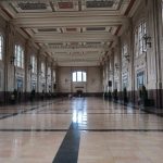
Even though the Grand Central Terminal (or: Grand Central Station) in New York City is a popular touristic attraction, it ...
It's about a month until I am back t the Faroe Islands. This time, I am traveling quite a lot ...
The German Olympic Sports Confederation (Deutscher Olympischer Sportbund) hired a complete stadium for their events during the Paris 2024 Olympic ...
Apart from being ill, the week at the Infosys Hall of Fame Open 2024 in Newport, Rhode Island, has truly ...
I really loved having a prolonged weekend in Vienna in June 2024. There is such a nice variety of interesting ...
Almost 4,000 hotel rooms, located right at the Strip - the Caesars Palace is undoubtedly one of the most famous ...
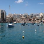
The Mediterranen island Malta is becoming a more and more popular tourist destination. My wife and I had a brief ...
The flora of the Faroe Islands is rather unique and special. A nice way to explore it is the Faroese ...
The Wiener Zentralfriedhof (Vienna Central Cemetery) is the one of the largest cemeteries in Europe. With over 300,000 graves and three million ...
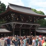
A visit to Japan would just not be complete without digging into the religion and visiting some temples and shrines ...
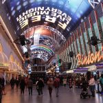
I feel that the more the Strip or Las Vegas Boulevard area is growing as a massive, but also expansive entertainment temple, ...
I rather frequently travel to Dublin for business reasons. However, the Weird Al Yankovic Tour 2023 gave me a rather ...
Especially in summer, East Frisia and the East Frisian Islands on the German North Sea coast are very popular tourist ...
Going back from Las Vegas to Los Angeles after the New Year's Eve celebrations, my wife and I opted to ...
During our visit to Dubrovnik, my wife and I also had a look into the Franciscan Monastery (sometimes also: Franciscan ...
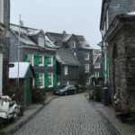
The Selfkant is truly a remarkable municipality in the very West of the Federal Republic of Germany. The border to ...
During my trip to the Faroe Islands in December 2023, KI Klaksvik made me see my first match at the ...
According to Wikipedia, twelve different railroad lines overall operated from and through Kansas City overall. However, the golden age of ...
As one of the first posting emerging from my September and October 2023 to Tokyo, I already introduced you to ...
KI Klaksvik's UEFA Conference League campaign in 2023 made me have a December visit to the Faroe Islands. Apart from ...
In New Year's Eve in 2013, my wife and I married in Las Vegas. We wanted the New Year's fireworks ...
When the Faroe Islands opened the Vagatunnilin, the Vagar Tunnel, in 2002, ,it was a revolution in their infrastructure. The almost ...
Winter and Christmas time is typically also a very spiritual and religious times of the year. Why not taking you ...
Last year, I had a longer weekend to Andorra. I still love to think back to the lovely time I ...
During my trip to the Faroe Islands, I did a couple of short road trips, typically to slightly more remote ...
Wacken could be just a normal village on the countryside of the German state of Schleswig-Hostein. However, when you mention the ...
The recent seismic and volcanic actions on the Reykjanes peninsula really touch me. Dung the last years, Iceland has more ...
The musical Rock of Ages lead me to several places, especially while chasing the U.K. Tour. In fall 2022, I had ...
The two world wars have caused significant damage to most German cities - especially those with a somehow-strategical meaning. Thus, ...
I recently introduced you to the Geothermal Exhibition at the Hellisheidi Power Plant. Due to the high geophysical activity in ...
One thing I was looking forward a lot during our recent trip to Japan were vending machines. We did not ...
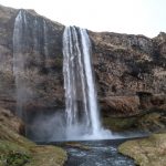
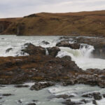
The are numerous and spectacular waterfalls in Iceland, spread all over the island. However, the Seljalandsfoss is one of the ...
One thing about tour-chasing is that it leads to several places in a rather short time. The Weird Al Yankovic ...
Lillehammer - the small Norwegian city, which became globally known in 1994, when it hosted the Olympic Winter Games. In ...
The blue and white flag was waving at quite a lot of houses and the (league) jersey was proudly presented ...
Copenhagen is definitely one of the most beautiful spots in Europe. One of the most iconic places of the city ...
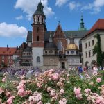
After I already took you to the "public" area of Wawel Castle in Krakow in a Pictured Story, here is ...
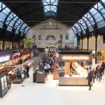
The Old Market Hall (Vanha Kauppahalli or - in Swedish - Helsingfors Gamla Saluhall) is one of the most iconic ...
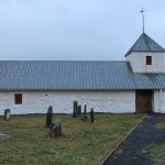
There is typically not too many religious contents on Flyctory.com. However, this posting is already the second church I introduce ...
The Wawel Royal Castle is likely the most iconic piece of architecture in Krakow. The castle is located above the ...
During the last years, I traveled to quite some places in the United Kingdom, which I likely wouldn't normally have ...
The much I loved Cyprus (and also the capital), the much visiting Nicosia has been depressing to me. Having all ...
I recently took you to Husavik, somehow Iceland's capital of whale watching nowadays and whaling in previous ages. New Bedford ...
When I look back at five years of tour-chasing the British cast of the musical Rock of Ages since 2018, ...
I have to give in, that is not a normal posting. I felt that with any major anniversary for Flyctory.com, ...
The black lava beaches of Iceland are one of the must visits to many tourists. One of the most well-known ...
Yeah, there are plenty of fantastic kinds of food made in Portugal. Think about different fish dishes, sweets - or ...
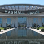
Shopping Malls are not that frequently presented on Flyctory.com. There are some exceptions like my posting about the Ibn Battuta ...
Visiting the Old Town of the capital city of Valletta is definitely one of the highlights of a trip to ...
I have to give in: the red carpet is not my favorite location. Nonetheless, I felt very thankful that after ...
Already in 2018, I introduced you to my thoughts about Manchester Airport (MAN). To sum it up: the airport has ...
When you pass North Huntingdon Southeast of Pittsburgh on the US-30, it feels like a very typical American city at ...
Palma Cathedral - or Catedral de Mallorca - is definitely one of the most iconic buildings in Palma. Of course, I did ...
Shall I do a review or a Pictured Story out of this place? I finally opted for the latter option ...
While I generally enjoy being in the United Arab Emirates due to climate and cultural diversity, I especially have a ...
I felt that the current discussions about the closing down of the village of Lützerrath in Germany are a good ...
Leadenhall Market is one of the most beautiful markets in London. The covered market in Central London has been initially ...
A trip to a Frequent Flyer meeting lead to a post about train rides: Less than two weeks after the ...
The German amusement park Phantasialand is regularly rated to be one of the best and especially most atmospheric spots of ...
Asam Church in Munich is regarded to be the most beautiful church in the Bavarian capital. Thus, on one of ...
Just two weekends before Christmas 2022, I have been to Tirana for the very first time. I was aiming to ...
Once upon a time there was an above-average bakery in Hoboken, New Jersey, right on the opposite site of the ...
My early October 2022 trip to Cyprus gave me a lot of great impressions - and I really started to ...
Many tourist traveling to Iceland put the day trip of the Golden Circle on the top of their list. Apart from ...
The Hohensyburg castle is located at a height of 245 meters above sea level in Southern Dortmund in Germany. While the castle ...
I typically miss when theaters offer tours during the time I have a booking for my favorite musical, Rock of ...
I guess there is a lot of things you think about when you think about Nashville. Country music, partying, honky-tonks, ...
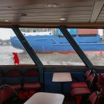
In the order of posting the episodes of my trip report of exploring Hamburg Habor (here is my overview posting ...
This episode of my Hamburg Public Ferry trip report takes you to my favorite route of all, Line 73 (see ...
The second posting about exploring Hamburg with the HADAG public ferries features Line 72, which is special in multiple aspects ...
Typically, my Trip Reports are like travel diaries. One posting per day, telling you all the stories of a trip, ...
If you follow Flyctory.com for a while, you know that I love the Northern Icelandic city of Akureyri. This posting ...
While Dubai and Abu Dhabi already attract masses of tourists, the North and East of the United Arab Emirates is ...
3,337 Waffle Houses Away in the little town of Paola, Kansas - I have heard these words so often. They ...
It's summer season in Iceland right now again. People explore the amazing highlands. While I still struggle to complete a ...
After I recently took you to Bethel Woods, the grounds of the legendary Woodstock Music Festival, in fact taking you ...
During my summer 2021 daytrip to Helgoland, I also needed the Dünenfähre ("Dune Ferry") to connect from the main island to the ...
Going to Pittsburgh is always very special to me. Typically, this means that there is a home match of my ...
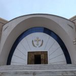
Akureyrarkirkja or simply the Akureyri Church is one of the key eyecatchers of the Northern Icelandic city. The Lutheran church, ...
When you think about libraries worth visiting as a tourist, you likely thing about historic places with old books. Helsinki, ...
During my September 2021 trip to Toronto, I also spent an evening at the beautiful historic district of Streetsville. The ...
Greetsiel is one of the popular villages in East Frisia, right at North Sea. Especially the picturesque harbor area is ...
For many Dubai tourists, especially first-timers, walking through the narrow streets of the Old Town and passing tons of jewelry ...
The abandoned settlement part of Al Madam in the East parts of the Emirate of Sharjah has become a hidden ...
I have to agree: if it comes to arts, especially modern arts, I am a real low-brow. You won't find ...
Due to its very good strategic location at the Baltic Sea, Gdansk has been an important settlement at least since ...
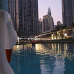
Especially for tourists, Dubai rather means entertainment, luxury and posh shopping. Thus, having a boat ride in a swan-shaped pedal ...
Especially when I am in London, visiting a stage play is always a must on my list (time permitting). One ...
The area around the world famous seven star hotel Burj al Arab (if someone is paying me a night there, ...
In order to collect some new material for Flyctory.com, I recently drove to Remscheid to cover some museums there. The ...
ByWard Market in Ottawa is a beautiful entertainment, shopping and relax district in the heart of the Canadian capital. During ...
What is your first thought about Iceland? I think many people associate the stunning, unique nature with the Nordic island ...
Seljalandsfoss, Skogafoss or Gullfoss - Iceland is full of very famous waterfalls. Urridafoss (which translates to "Sea Trout Waterfall") is ...
Hverir is one of the most popular geothermal areas in Northern Iceland. Two the key drivers is obviously that it ...
When I told a colleague I will be in Krakow in late August 2021, his reaction was "Is it still ...
What is the shortest flight time between Canada and the European Union? Can you walk from the USA to Russia? ...
The Pictured Story postings give me a nice opportunity to share moments with you, which might not be worth a proper review ...
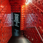
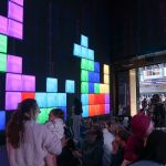
More than 5,000 small buckets one next to another in a bunch of aisles within one store. The contents: interlocking ...
15 meters of total height, thereof a the height of the light itself at eleven meters - the Pilsum Light ...
Due to their high incidences on the delta variant of Covid-19, the United Kingdom is still / again in the ...
During my recent daytrip to Berlin, I took the opportunity to have a walk through sunny - and empty - ...
I have always been wondering how people from cities like Lockerbie or Lakehurst deal with the faith that their hometown ...
Travelling in Germany has been turned down to an absolute minimum. Hotels are just able to accept business guests and ...
If an industrial site is jokingly called the Eiffel Tower of the Ruhrgebiet Region, it seems to be quite an impressive ...
While the Ibn Battuta Mall is my definite shopping favorite in Dubai, my love about spending some money in Abu ...
During my December 2020 trip to Dubai, I stayed in two hotels in the Al Seef district. The area is ...
Not too rarely, you find the Paseo de Canarias in Firgas as a cover photo of Gran Canaria / Grand Canary ...
Before the pandemic limitations, One New Change Mall in London has been a really popular place. First of all, it ...
The Canary Islands have not only been a key hub for maritime travels (Gran Canaria has, for example, been a ...
I assue that there is hardly any travel guide for London, which is mentioning the Namco Funscape as an important ...
I am not too much in Harry Potter - but therefor, my wife is compensating my lack of knowledge. After ...
Sometimes, you just have to be creative: if you have one of the biggest mobile ferris wheels in the neighboring ...
The Elbphilharmonie (Elbe Philharmonic Hall), which has been built between 2007 and 2016 and opened on 11th January 2017, is something like ...
Hangar 7 at Salzburg Airport, driven by (likely) the world leader of energy drinks, is a quite popular and well ...
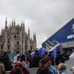
Culture freaks may argue that Milan is nothing without the Scala and sports fans think about iconic soccer battles - ...
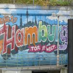
Hamburg has a lot of famous attraction: some might first think about the huge harbor, others about the new Elbphilharmonie (Elbe ...
When people think about the United Arab Emirates, they typically think of Dubai or Abu Dhabi. During my last trips, ...
One thing I especially loved about Jersey's capital St. Helier are the two markets in the center of the city ...
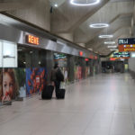
Regarding passenger flights, my hometown airport Cologne / Bonn is only the seventh biggest in Germany, servicing some 12 million ...
Clarke Quay in Singapore is one of the most well-known (and most touristic) entertainment districts in the center of the ...
During a recent business trip to Dublin, I walked from my hotel, The Morrison, to our office in the financlal ...

 by
by