 by
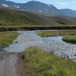
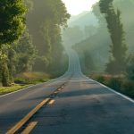
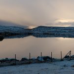
by In this Pictured Story, I want to take you on a road trip in Iceland which I in fact already took in October 2021. Right after visiting Urridafoss, Iceland’s largest waterfall if you measure it by the volume of water processed, I headed to the Southern Coast of the country. The day was quite unique – it was rather sunny in the morning, but then there were quite significant snowfalls so that even the Ring Road #1 had to be closed temporarily. Enjoy these impressions from my little tour, which overall did not take more than 45 minutes (including several photo stops), but had some really nice views.
Icelands South Coast on Routes 33/34 – Overview
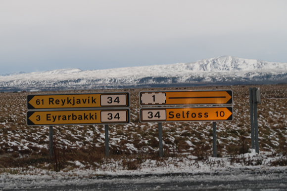
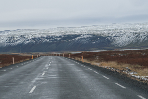
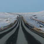
From the waterfall, I headed down the Urridafossvegur Southbound and then – after a few hundred meters on the Villingaholtsvegur, further South on the 308, Hamarsvegur. All the streets are well paved or well-to-drive unpaved roads so that you should typically be able to use them with a normal (non 4WD) car. The road trip in fact starts when the 308 crosses route 33, close to the old Gaulverjaskoli school house, which nowadays seems to be an accommodation.
From that place on, I headed South towards the Olfus. Near Eyrarbakki, route 33 merges into route 34. I turned left to follow the coastline. My road trip ends where route 34 merges into route 38 near Ölfus. On the part of the trip covered by the Pictured Story, the city of Stokkseyri offers all kind of services (hotel, food, petrol). Alternatively, you find these things in Ölfus as well. Eyrarbakki also has a petrol station. The car I used was a Dacia Duster 4WD, which I rented with Blue Car Rental.
Icelands South Coast on Routes 33/34 – Impressions
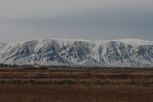
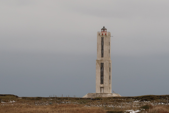
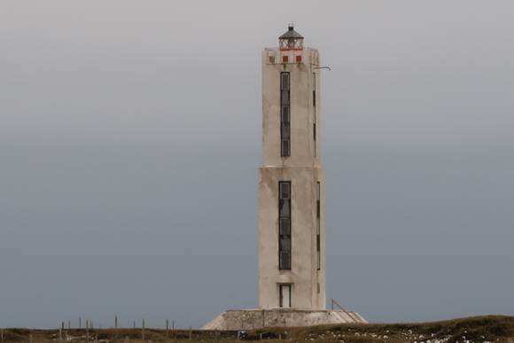
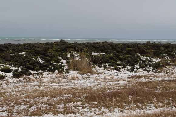
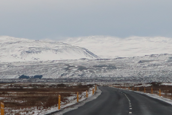
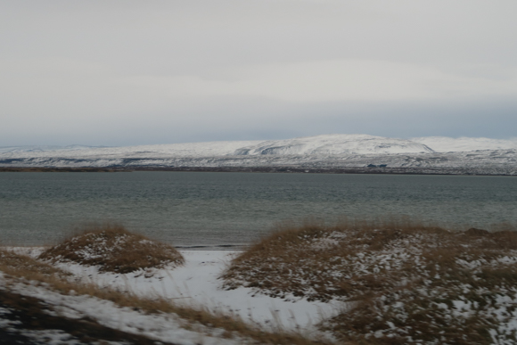
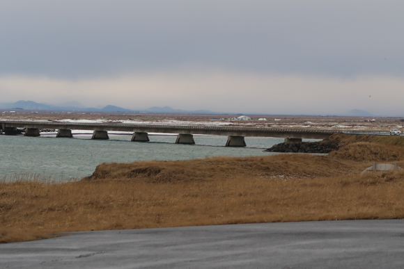
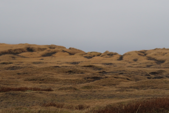
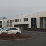
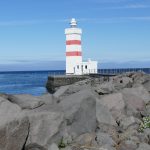
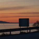
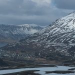
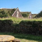
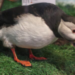
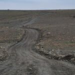
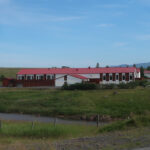
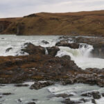
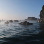
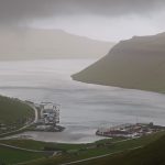
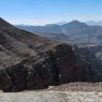
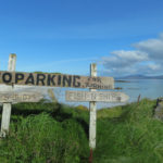
The weather on that day was simply amazing – even right before I entered the road 33, the snowy mountains in the background gave a lovely view. I did not plan to go for this posting, but it was just too appealing to do it. At the old school, I entered road 33 Southbound. Most of the area is somehow farmland, the coastal area is also great for birdwatching (if there is no breeding season and you disturb the animals). Icelandic Horses are also a big thing in this area, one of the pictures you see featured the GobbiGobb Horse Center, for example. The old creamery in this area was unfortunately close, so that the next stop was at Knarrarósviti, “Knarraros Lighthouse”, a rather iconic landmark on the trip. If you take a hike there in summer, you likely make friends with the local horse breed.
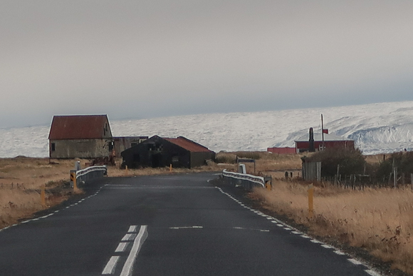
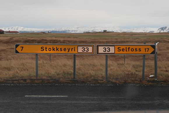


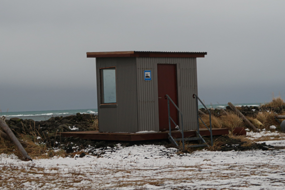
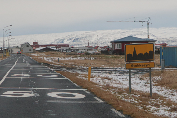
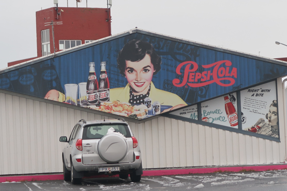
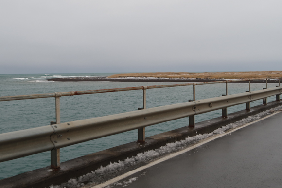
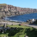
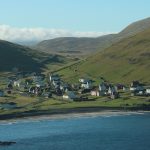
The road is now really next to the water and there is are major ponds on the land side as well. Some places also allow very well to review the volcanic activity in the area. The largest village on the trip is Stokkseyri, which is stretching along the coast line and offers some services. I liked the mural at the local supermarket (which is rather modern, by the way – if you compare it to Google Street View, you see that they don’t have it). The area also offers several oppprtunities to stop the car and enjoy beach views. Soon after leaving Stokkseyri, I started to follow route 34.

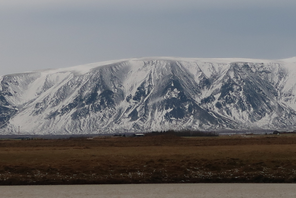


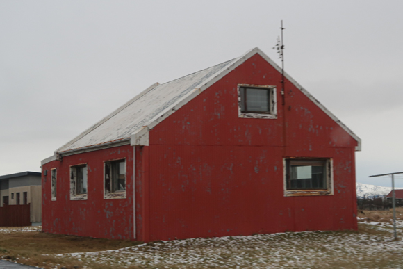

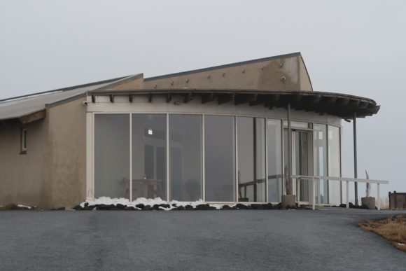
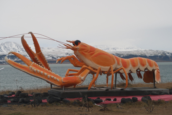
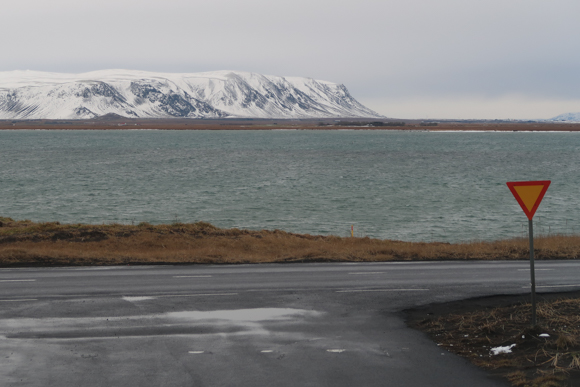
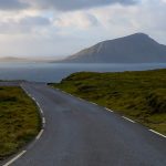
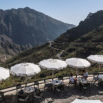
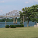
Getting closer to the mountains now, the view got even better now. Eyrarbakki is a neat village quite soon after the road crossing, which does not offer too many touristic facilities apart from horse riding tour companies. You now cross the fjord created by the Ölfusa river. Right on the left hand side lies the picturesque Hafid Blaa restaurant. It was closed during my visit and it is shown to be closed on Google Maps at the time of writing this posting. The Lobster by the Sea statue is an eye-catcher. In general this has been another lovely part of the trip, being surrounded by water from both sides, before I went on towards Keflavik on route 38 and the trip came to an end.


Travel Postings about Iceland
Here are all my travel-related postings about Iceland:

Food I Had Onboard XXX

Jokulsarlon Glacier lake & Diamond Beach (Pictured Story)
Fosshotel Reykholt
The Most Airports by Country I Have Flown To
Hotel 1001 Nott (Egilsstadir, Iceland)
Food I Had Onboard XX (November 2024 – early January 2025)
Stracta Hotel Hella (Iceland)
Husavik Whale Museum
Krauma Geothermal Spa (Reykholt, Iceland)
22 Hill Hotel (Reykjavik)
A Short Roadtrip along Northwest Reykjanes
Hveradalir Geothermal Area (Pictured Story)
The Waterfalls near Seljalandsfoss (Pictured Story)
Geothermal Exhibition at Hellisheidi Power Plant
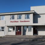
Post-Plaza Guesthouse Husavik

Reykjavik Family Park & Zoo

Vök Baths (Egilsstadir)
Daladyrd Petting Zoo (near Akureyri)

Icelandair Boeing 737 MAX Saga Premium Class

Airport Hotel Aurora Star Keflavik

Skyrland Selfoss
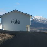
Hafdals Hotel Akureyri
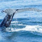
Whale Watching with North Sailing Husavik (Iceland)

Dyrholaey (Iceland, Pictured Story)
Lava Show Reykjavik
Puffin Watching at Hafnarholmi in Northeast Iceland
Hrafnavellir Guest House (Hornafirdi, Iceland)

My Traveler’s Thoughts About… Renting a Car and Driving in Iceland

Forest Lagoon Akureyri
Food I Had Onboard VIII (April 2023 til Mid-May 2023)

Husavik Eurovision Exhibition
Traveling on Iceland’s Ring Road (Reprise)

Traveling on Iceland’s Ring Road (Day 8 – 6th May 2023) – Day in Reykjavik & More
Traveling on Iceland’s Ring Road (Day 7 – 5th May 2023) – Reykholt to Reykjavik
Traveling on Iceland’s Ring Road (Day 6 – 4th May 2023) – Akureyri to Reykholt

Traveling on Iceland’s Ring Road (Day 5 – 3rd May 2023) – Husavik to Akureyri
Traveling on Iceland’s Ring Road (Day 4 – 2nd May 2023) – Egilsstadir to Husavik
Traveling on Iceland’s Ring Road (Day 3 – 1st May 2023) – Hrafnavellir to Egilsstadir

Traveling on Iceland’s Ring Road (Day 2 – 30th April 2023) – Hella to Hrafnavellir
Traveling on Iceland’s Ring Road (Day 1 – 29th April 2023) – Germany to Hella
Traveling on Iceland’s Ring Road (Preview)

Five Years of Flyctory.com – My 20 Most Popular Travel Posts (so far…)
Reykjavik Maritime Museum

Gullfoss – Iceland’s Most Famous Waterfall? (Pictured Story)

View Over Akureyri from Hlidarfljall

Ystafell Auto Museum (Iceland)
A (Partial) Trip along F899 (Flateyjardalsvegur – Pictured Story)
Icelandic Aviation Museum (Akureyri)
Flying with Icelandair Domestic (Flygfelag Islands / Air Iceland Connect)
Icelandair Hotel Reykjavik Natura

Akureyrarkirkja – Akureyri Church

Cruising on the Herjolfur Vestmannaeyjar Ferry
Grenjadarstadur Turf House Museum

Viking World (Nardvik, Iceland)
Sagnheimar Natural History Museum Vestmannaeyjar
The Settlement Exhibition Reykjavik

Whales of Iceland (Reykjavik)
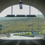
Vadlaheidargong Toll Tunnel and Alternatives
Keflavik Airport (KEF)
The F35 Kjölur-Route in Iceland

Rokksafn – The Icelandic Rock’n’Roll Museum (Reykjanesbaer)

Airport Hotel Grasteinn (Keflavik)
Egilsstadir Airport (EGS)
Hallgrimskirkja Reykjavic – Church and View from Tower

Saga Museum Reykjavik

Hilton Reykjavik Nordica

Reykjavik Domestic Airport (RKV)
Flying Norlandair from Akureyri (AEY) (not) to Grimsey (GRY)
Iceland Road F347 (Kerlingarfjallavegur) and Hveradalir
Hotel Kjarnalundur (Akureyri, Iceland)

Aurora Reykjavik

LAVA Centre Hvölsvollur (Iceland)

Geysir Hot Spring Area (Iceland – Pictured Story)

Food I Had Onboard (Oct 2021 til Nov 2021)

Car Rental Review – Blue Car Keflavik Airport (KEF) – Dacia Duster 4WD
Hotel Laxarbakki (Akranes, Iceland)
Urridafoss – The Highest Flow Waterfall in Iceland (Pictured Story)
Hotel Duus (Keflavik)
Icelandic Punk Museum (Reykjavik)

Olis Deildin (Icelandic Handball Premier League) with Fram Reykjavik at Safamyri Hall
Hertz Deildin Div. 1(Icelandic Ice Hockey League) with Fjölnir Reykjavik at Egilshöll

Car Rental Review – Procar Keflavik Airport (KEF) – Dacia Duster 4WD

Hverir Geothermal Area (Pictured Story)
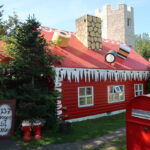
Eyjafjördur Jolahusid – The Christmas House
Myvatn – Natural Thermal Pool in Northern Iceland

Car Rental Review – Geysir Keflavik Airport (KEF) – Dacia Duster 4WD

The Bridge Between Europe and North America (Pictured Story)

Boeing 757-200 Icelandair Saga Premium Class
Litli Geysir Hotel

Icelandic Phallological Museum (Reykjavik)

Saga Lounge Kefklavik (KEF)
Akureyri Airport (AEY)
Sky Lagoon Reykjavic / Kopavogur
Postings about Road Trips
Here are all road trips on Flyctory.com
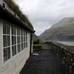
A Trip To Nordradalur (Faroe Islands, Pictured Story)
Red Rock Canyon Scenic Drive
Gasadalur and the Mulafossur Waterfall (Pictured Story)
Driving the Oyggjarvegur (Route 50) on the Faroe Islands

Driving over the Coll d’Ordino (Andorra CS-240/-340)
Six US States And Nashville (Day 10 – 8th June 2025) – Back in Evansville

Six US States And Nashville (Day 9 – 7th June 2025) – The Colonel and Baseball
Six US States And Nashville (Day 8 – 6th June 2025) – A Day In The Smokies
Six US States And Nashville (Day 7 – 5th June 2025) – Riding With Dolly
Six US States And Nashville (Day 6 – 4th June 2025) – Rockets and Veterans

Six US States And Nashville (Day 5 – 3rd June 2025) – A Daytrip To Charlotte
Six US States And Nashville (Day 4 – 2nd June 2025) – Sweet Home (?), Alabama

Six US States And Nashville (Day 3 – 1st June 2025) – Sunday in Nashville

Six US States And Nashville (Day 2 – 31st May 2025) – Back To Music City

Six US States And Nashville (Day 1 – 30th May 2025) – My First Flight To Indiana
Six US States And Nashville – A Preview
Driving on the Runt Agnið (Faroe Islands)
Exploring the West Coast of Sandoy from Sandur (Faroe Islands)
Traveling along the Liwa Forts Oasis Route (U.A.E.)
Views of Sandoy Island (Faroe Islands)
Crossing the Atlantic Ocean in the Sandoyartunnilin (Sandoy Tunnel)

Eysturoyartunnilin – The First Sub-Sea Roundabout in the World
A Trip To Saksun (Faroe Islands, Pictured Story)
A Short Roadtrip along Northwest Reykjanes
Traveling on Iceland’s Ring Road (Reprise)
Traveling on Iceland’s Ring Road (Day 8 – 6th May 2023) – Day in Reykjavik & More
Traveling on Iceland’s Ring Road (Day 7 – 5th May 2023) – Reykholt to Reykjavik
Traveling on Iceland’s Ring Road (Day 6 – 4th May 2023) – Akureyri to Reykholt
Traveling on Iceland’s Ring Road (Day 5 – 3rd May 2023) – Husavik to Akureyri
Traveling on Iceland’s Ring Road (Day 4 – 2nd May 2023) – Egilsstadir to Husavik
Traveling on Iceland’s Ring Road (Day 3 – 1st May 2023) – Hrafnavellir to Egilsstadir
Traveling on Iceland’s Ring Road (Day 2 – 30th April 2023) – Hella to Hrafnavellir
Traveling on Iceland’s Ring Road (Day 1 – 29th April 2023) – Germany to Hella
Traveling on Iceland’s Ring Road (Preview)
A (Partial) Trip along F899 (Flateyjardalsvegur – Pictured Story)
Driving Up Jebel Jais Mountain
Following The Pittsburgh Penguins in March 2022 (Day 7, 16th March 2022)
Vadlaheidargong Toll Tunnel and Alternatives
The F35 Kjölur-Route in Iceland
Flyctory.com Best Ones 2021
Iceland Road F347 (Kerlingarfjallavegur) and Hveradalir
Rossfeld Panoramic Route
Tenerife – TF-436 Route and Teno Alto

Punta Del Teno Lighthouse and TF-445 Road (Tenerife)
Exploring Barra With Barra Island Tours
Weird Al & Grass Court Tennis 2019 (Day 5/6 – 21st/22nd July 2019)

Weird Al & Grass Court Tennis 2019 (Day 4 – 20th July 2019)

Weird Al & Grass Court Tennis 2019 (Day 3 – 19th July 2019)

Weird Al & Grass Court Tennis 2019 (Day 2 – 18th July 2019)

Weird Al & Grass Court Tennis 2019 (Day 1 – 17th July 2019)

A Musical Trip to CMA Fest 2019 (Day 6 – 5th June 2019)
A Musical Trip to CMA Fest 2019 (Day 5 – 4th June 2019)

A Musical Trip to CMA Fest 2019 (Day 4 – 3rd June 2019)
A Musical Trip to CMA Fest 2019 (Day 3 – 2nd June 2019)
A Musical Trip to CMA Fest 2019 (Day 2 – 1st June 2019)
A Musical Trip to CMA Fest 2019 (Day 1 – 31st May 2019)

Trip Report: On Tour with Weird Al Yankovic (Day 5&6)

Trip Report: On Tour with Weird Al Yankovic (Day 4)

Trip Report: On Tour with Weird Al Yankovic (Day 3)
Trip Report: On Tour with Weird Al Yankovic (Day 2)

Trip Report: On Tour with Weird Al Yankovic (Day 1)