 by
by I have quite a backlog of postings related to the Faroe Islands. This time, I want to take you on a short road trip I did in December 2023 already. The Runt Agnið (“Around Agnið”) is a just some five kilometer long drive, which is marked as one of the scenic routes on the Faroe Islands. Hope you enjoy the trip with me in my Pictured Story.
Runt Agnið – The Trip
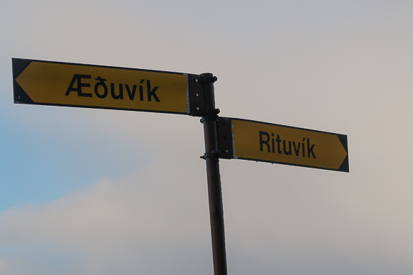
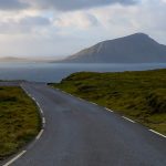
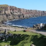
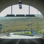
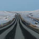
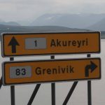
Runt Agnið is a public road on the Southern end of Eysturoy island. It starts at the town of Nes, South of Tofitr and (strictly speaking) ends at the Myravegur connecting Runavik and Rituvik. I start my overage leaving Nes and close the coverage in Rituvik, though. The total distance of the trip is 5km. If you would not stop en route, it would take you less than ten minutes. My trip took me about 20 minutes, though. The road is listed as road 95 and 68. It is also worth taking a detour to Aeduvik, which I did not do for the sake of this posting. From Torshavn, you can either use the toll tunnel Eysturoyartunnilin or routes 10 and 15 to get to the area.
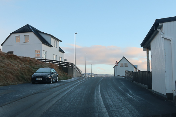
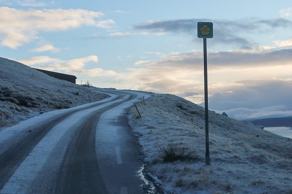
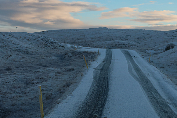
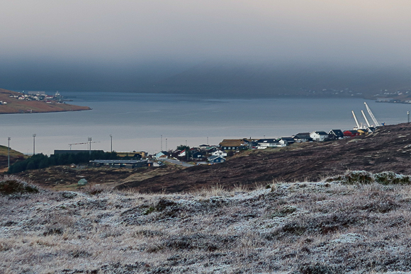
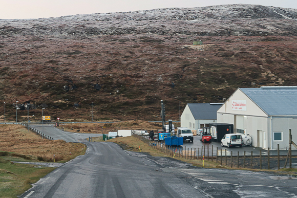
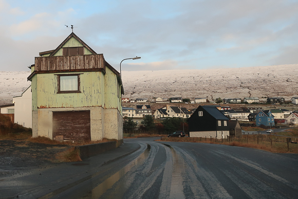
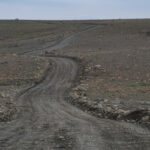
Nes is majorly known for its former WWII fortress and an abandoned church. Rituvik is beautifully located in a bay and has a small harbor. Nes has a population of some 370 people, Rituvik is slightly smaller. Touristic facilities like gas stations, restaurants or grocery stores are available in Toftir and Runavik. Parts of the trip are on narrow, but paved roads. As you see, I took the trip during slightly snowy conditions in December. Apart from having proper tires, you don’t need a special kind of car to travel the route.
Views of Runt Agnið
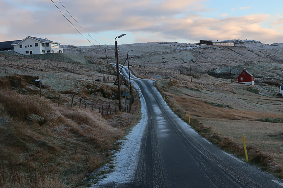
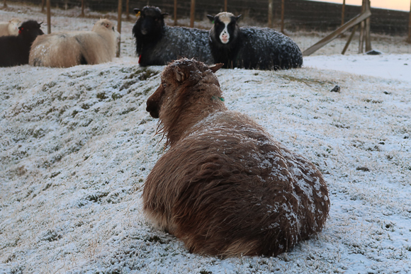
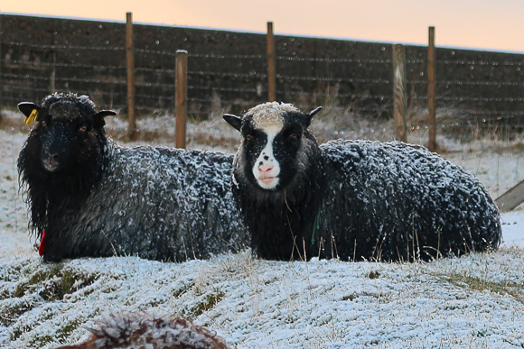
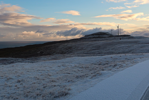
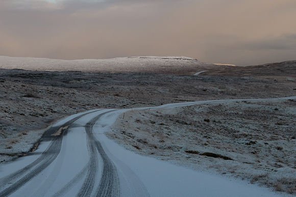
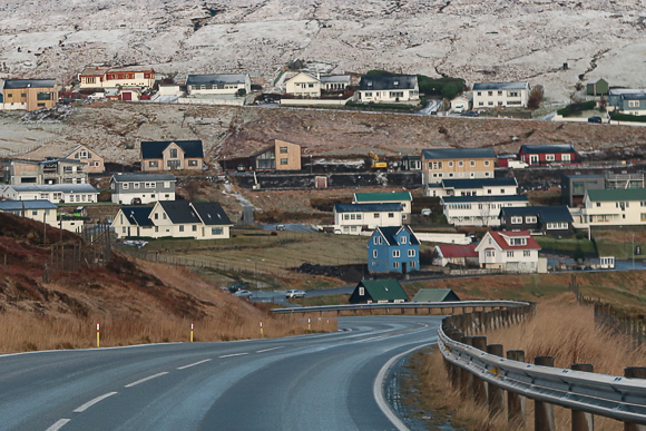
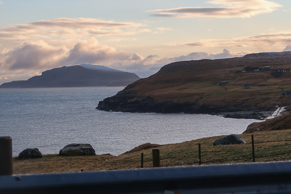
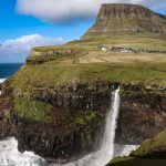
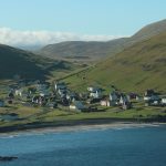
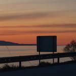
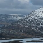
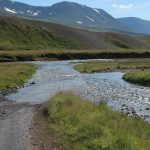
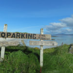
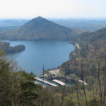
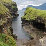
On the first picture of my post, you see the last houses of Nes. The road is initially heading into East direction, before a serpentine is offering beautiful views of the village. The narrow road circles a small lake as well as some snow sheep (you might not have them during your visit…). There is a short route South to to a wind farm. After crossing a minor hill, you also have a first look into the bay of Rituvik and can head down South to Aeduvik. I took the direct route North, though, and just had a look from the top of the hill.
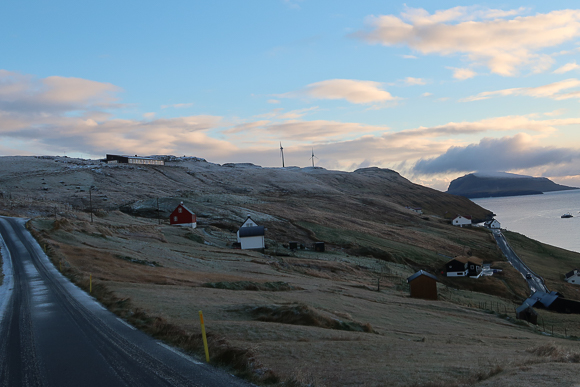
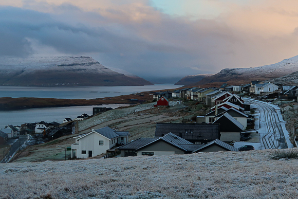
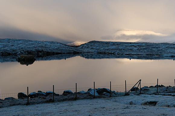
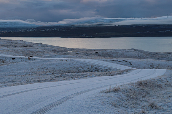
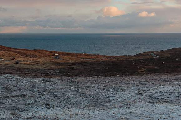
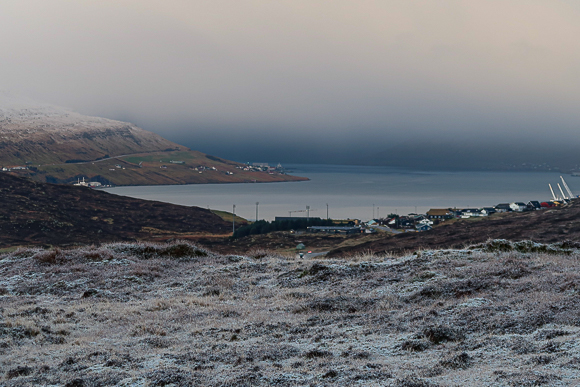
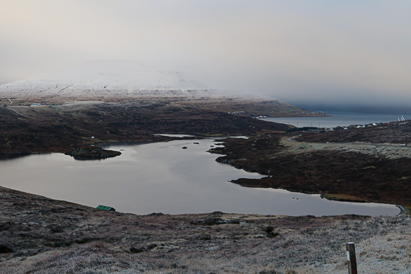
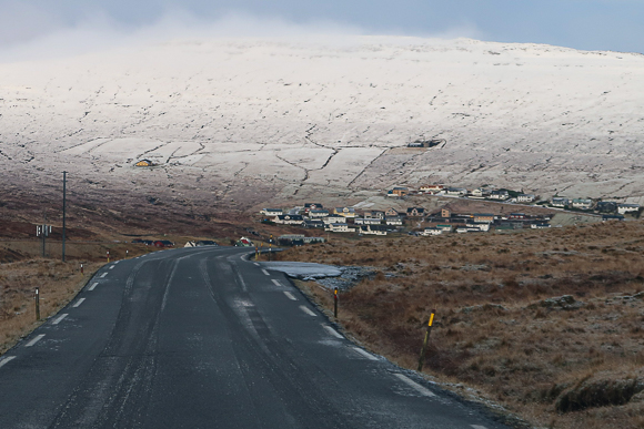
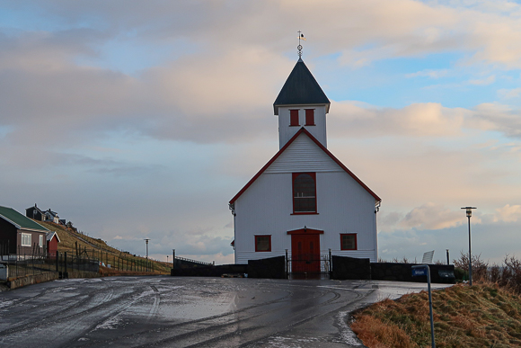
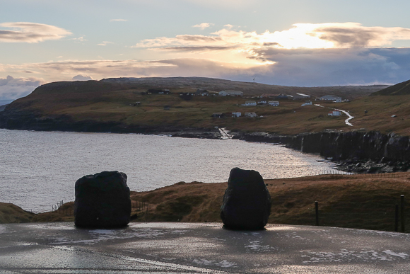
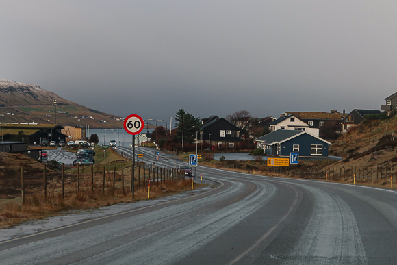
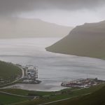
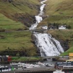
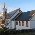
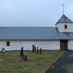
From there, you can already spot the first houses of Rituvik and the lovely mountain in the background. I especially loved the early winter scenery during my trip. At Myravegur, I headed North into the beautiful small village of Rituvik. As in many Faroese settlements, the local church is one of the key eye-catchers. The parking lot right in front of Rituvikar Kirkja is a beautiful spot to enjoy the scenery in and around the bay, including views of the Atlantic Ocean.
Postings about Road Trips
Here are all road trips on Flyctory.com
A Trip To Nordradalur (Faroe Islands, Pictured Story)
Red Rock Canyon Scenic Drive
Gasadalur and the Mulafossur Waterfall (Pictured Story)
Driving the Oyggjarvegur (Route 50) on the Faroe Islands

Driving over the Coll d’Ordino (Andorra CS-240/-340)
Six US States And Nashville (Day 10 – 8th June 2025) – Back in Evansville

Six US States And Nashville (Day 9 – 7th June 2025) – The Colonel and Baseball
Six US States And Nashville (Day 8 – 6th June 2025) – A Day In The Smokies

Six US States And Nashville (Day 7 – 5th June 2025) – Riding With Dolly
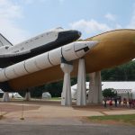
Six US States And Nashville (Day 6 – 4th June 2025) – Rockets and Veterans

Six US States And Nashville (Day 5 – 3rd June 2025) – A Daytrip To Charlotte
Six US States And Nashville (Day 4 – 2nd June 2025) – Sweet Home (?), Alabama

Six US States And Nashville (Day 3 – 1st June 2025) – Sunday in Nashville

Six US States And Nashville (Day 2 – 31st May 2025) – Back To Music City

Six US States And Nashville (Day 1 – 30th May 2025) – My First Flight To Indiana
Six US States And Nashville – A Preview
Exploring the West Coast of Sandoy from Sandur (Faroe Islands)
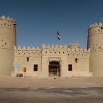
Traveling along the Liwa Forts Oasis Route (U.A.E.)
Views of Sandoy Island (Faroe Islands)
Crossing the Atlantic Ocean in the Sandoyartunnilin (Sandoy Tunnel)

Eysturoyartunnilin – The First Sub-Sea Roundabout in the World
A Trip To Saksun (Faroe Islands, Pictured Story)
A Short Roadtrip along Northwest Reykjanes
Traveling on Iceland’s Ring Road (Reprise)

Traveling on Iceland’s Ring Road (Day 8 – 6th May 2023) – Day in Reykjavik & More
Traveling on Iceland’s Ring Road (Day 7 – 5th May 2023) – Reykholt to Reykjavik
Traveling on Iceland’s Ring Road (Day 6 – 4th May 2023) – Akureyri to Reykholt

Traveling on Iceland’s Ring Road (Day 5 – 3rd May 2023) – Husavik to Akureyri
Traveling on Iceland’s Ring Road (Day 4 – 2nd May 2023) – Egilsstadir to Husavik
Traveling on Iceland’s Ring Road (Day 3 – 1st May 2023) – Hrafnavellir to Egilsstadir

Traveling on Iceland’s Ring Road (Day 2 – 30th April 2023) – Hella to Hrafnavellir
Traveling on Iceland’s Ring Road (Day 1 – 29th April 2023) – Germany to Hella
Traveling on Iceland’s Ring Road (Preview)
Icelands South Coast at Routes 33 and 34 (Road Trip)
A (Partial) Trip along F899 (Flateyjardalsvegur – Pictured Story)
Driving Up Jebel Jais Mountain

Following The Pittsburgh Penguins in March 2022 (Day 7, 16th March 2022)
Vadlaheidargong Toll Tunnel and Alternatives
The F35 Kjölur-Route in Iceland
Flyctory.com Best Ones 2021
Iceland Road F347 (Kerlingarfjallavegur) and Hveradalir
Rossfeld Panoramic Route
Tenerife – TF-436 Route and Teno Alto

Punta Del Teno Lighthouse and TF-445 Road (Tenerife)
Exploring Barra With Barra Island Tours
Weird Al & Grass Court Tennis 2019 (Day 5/6 – 21st/22nd July 2019)

Weird Al & Grass Court Tennis 2019 (Day 4 – 20th July 2019)

Weird Al & Grass Court Tennis 2019 (Day 3 – 19th July 2019)

Weird Al & Grass Court Tennis 2019 (Day 2 – 18th July 2019)

Weird Al & Grass Court Tennis 2019 (Day 1 – 17th July 2019)

A Musical Trip to CMA Fest 2019 (Day 6 – 5th June 2019)
A Musical Trip to CMA Fest 2019 (Day 5 – 4th June 2019)

A Musical Trip to CMA Fest 2019 (Day 4 – 3rd June 2019)
A Musical Trip to CMA Fest 2019 (Day 3 – 2nd June 2019)
A Musical Trip to CMA Fest 2019 (Day 2 – 1st June 2019)
A Musical Trip to CMA Fest 2019 (Day 1 – 31st May 2019)

Trip Report: On Tour with Weird Al Yankovic (Day 5&6)

Trip Report: On Tour with Weird Al Yankovic (Day 4)

Trip Report: On Tour with Weird Al Yankovic (Day 3)
Trip Report: On Tour with Weird Al Yankovic (Day 2)

Trip Report: On Tour with Weird Al Yankovic (Day 1)

Trip Report: On Tour with Weird Al Yankovic (Preview)
Pictured Stories (Faroe Islands)
Here are all my Pictured Stories related to the Faroe Islands:
A Trip To Nordradalur (Faroe Islands, Pictured Story)

Visiting the Muli Ghost Town (Faroe Islands)

Faroe Islands Fans at The EHF Euro 2026 in Oslo
Waterfalls on the Faroe Islands (Pictured Story)
Gasadalur and the Mulafossur Waterfall (Pictured Story)
Driving the Oyggjarvegur (Route 50) on the Faroe Islands
A Trip To Gjogv (Faroe Islands, Pictured Story)
Torshavn Cathedral (Pictured Story)
Exploring the West Coast of Sandoy from Sandur (Faroe Islands)
Skansin (Torshavn)
Views of Sandoy Island (Faroe Islands)
Crossing the Atlantic Ocean in the Sandoyartunnilin (Sandoy Tunnel)
Torshavn – Old Town and Tinganes (Pictured Story)
Faroese National Botanical Garden (Pictured Story)
Svangaskard – The Traditional National Stadium of the Faroe Islands
A Visit To Kirkjubour (Faroe Islands – Pictured Story)
Eysturoyartunnilin – The First Sub-Sea Roundabout in the World
A Trip To Saksun (Faroe Islands, Pictured Story)