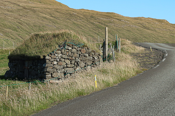
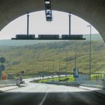
The rather recently opened Sandoyartunnilin (Sandoy Tunnel) allowed me to travel to the Southern island of the Faroe Islands for the first time of my life. Unfortunately, I had some timing and organizational issues, so that I did not have as much time as I expected to have there. Nonetheless, I felt, it is absolutely worth sharing some impressions from there, based on my September 2024 visit. Let’s take you to another Flyctory.com Pictured Story.
Sandoy – Location & Transport
Regarding the area, Sandoy is the fifth largest islands of the Faroe Islands. There are only roughly 1,200 inhabitants, which leads to a population density of some eleven people per square kilometer. This also means that relatively small villages are rather widely separated from each other. The main settlement of the island is Sandur, where almost half of the population of the island is living. The major island on the North is Streymoy, where also the capital Torshavn is located. In the South, there is the larger and significantly more populated island of Suduroy. There is no ferry between the islands, but discussions about an additional sub-sea tunnel. Sandoy is, however, the gateway to the little island of Skuvoy.
There are overall two possibilities to get to Sandoy. The Sandoyartunnilin replaced the ferry service and is the most convenient option. If you go for that option, this typically means you have a rental car and gives you the best options to travel around on the island. The tunnel also opened the opportunity to travel from Torshavn to Sandur by public bus. There are a few services per day and a bus connection between the main settlements of the island. There is no heliport for the scheduled helicopter services by Atlantic Airways on the island.
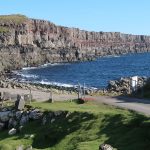
Views of Sandoy
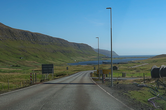
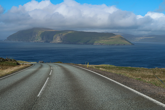
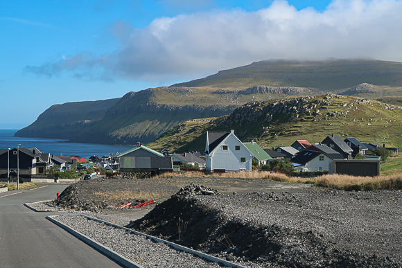
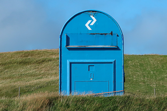
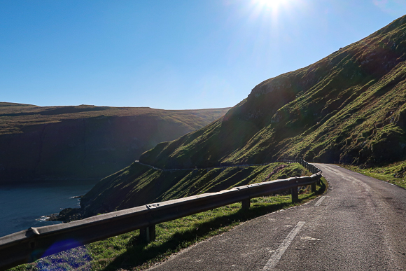
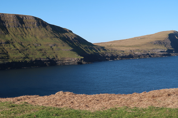
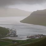
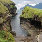
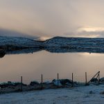
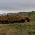
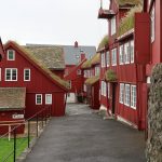
My pictures starts at the Sandsvatn lake, North of Sandur. I first headed North towards Skopun, the Northernmost settlement on the island. I was very lucky to have such a sunny day. The city used to be the port for the ferries to the smaller island of Hestur (which you see in one of the pictures below) and the main island Streymoy. With the introuduction of the tunnel, the ferry is solely connecting Streymoy and Hestur. Nowdays, the key sight of the picturesque village is the world largest blue post box, which is not really worth the trip. But the town as such is definitely a beauty and nicely reflects typical Faroese life.


The Southeast
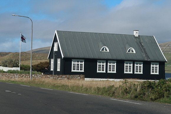
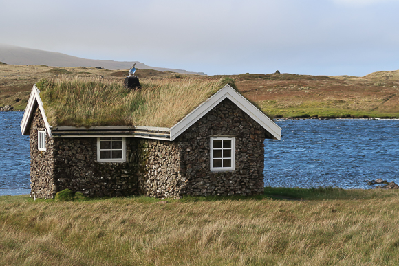
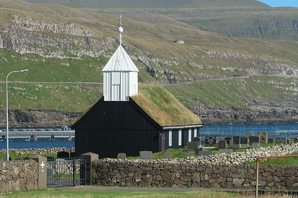
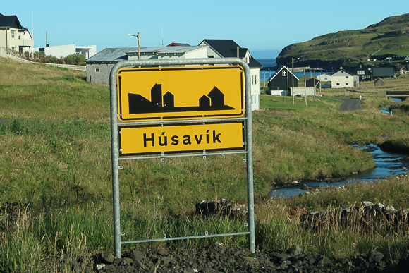
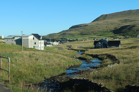
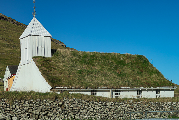
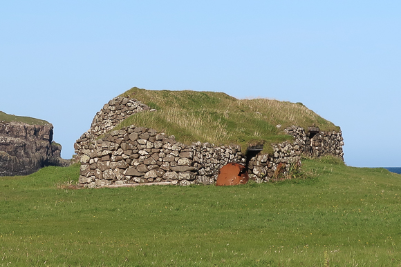
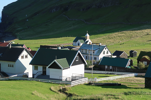
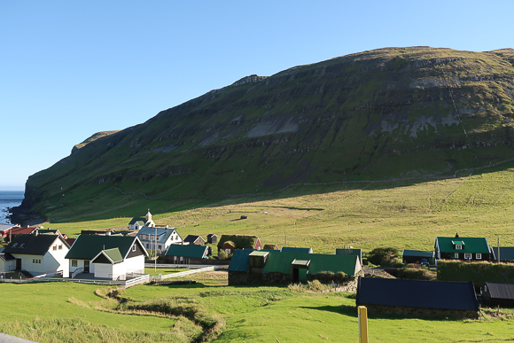
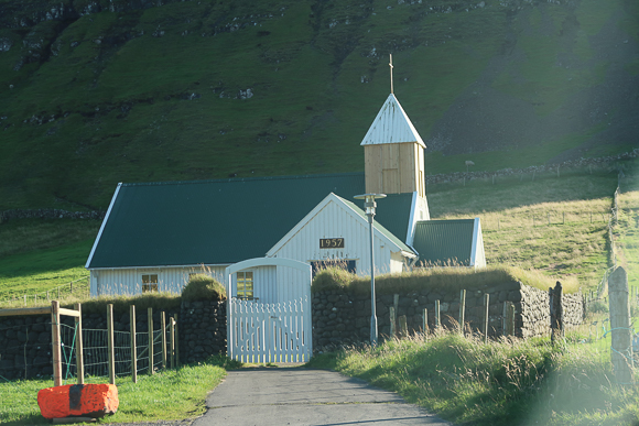
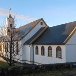
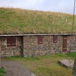
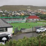
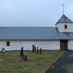
Honestly, Sandur is a very practical spot for your Sandoy trip, as it features gas stations and grocery stores – but I did not like it that much from a photographic perspective. There will be a separate Pictured Story of a short road trip I took from there to the West Coast, though. I thus headed to the Southeast. The first village I passed was Husavik. There is an equivalently-named city, which is one of my favorite spots in Iceland, so avoid confusion. This place is having some 120 inhabitants. It is beautifully located in a small bay at the East coast. Especially the turf-roofed church and the traditional buildings are eye-catchers.


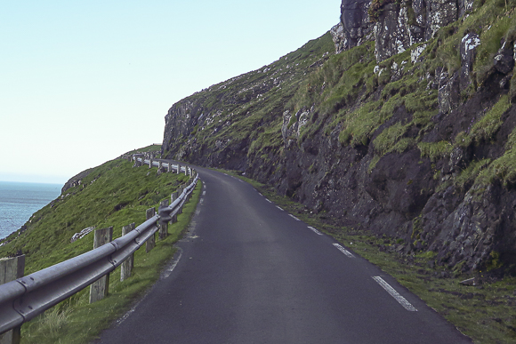
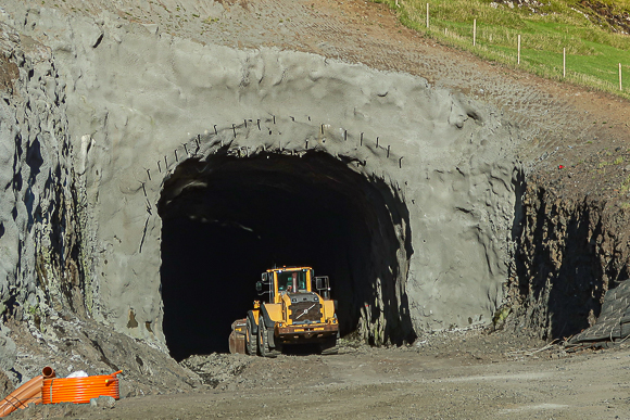
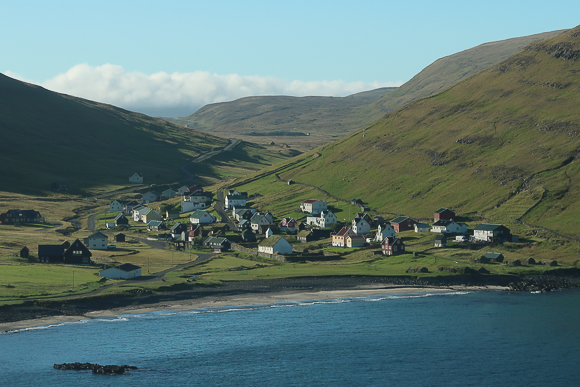
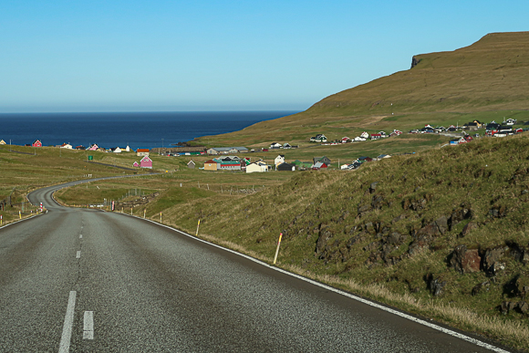
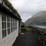
A narrow one-lane street (with turnout spots) heads on to Dalur. There will be a tunnel from Husavik to Dalur soon, which will ease the commute, but therefor reduces Faroese road trip romantics. When you come via the traditional road, Dalur is located in a valley of a bay and is thus absolutely picturesque. Tourists may especially like staying at the camping ground next to the Atlantic Ocean. I absolutely enjoyed having a short stay there.


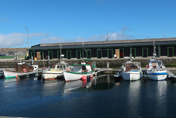
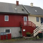
I had an overnight at Skalavik, which is a little smaller than Husavik. There are two places for accommodation. The city is also known as a good starting point for hikes. However, you won’t find dining services, gas stations or grocery stores there. Again, it is a typical Faroese harbor town.


Faroe Islands
Here are my postings related to the Faroe Islands:

The Faroe Islands are not only the islands of beautiful nature and countless sheep, but also a territory full of ...

My September 2025 edition of the Food I Had Onboard already starts with some experiences in late August. Again, there is ...

Overall, I had significantly more plans to explore places and sights on the Faroe Islands during my trip last week ...

The last sports event on my October 2025 trip to the Faroe Islands was a soccer qualification match to the ...

I am still on the Faroe Islands, briefly before I am about to leave my favorite islands. There is also ...

9th October 2025 featured the highlight of my trip to the Faroe Islands. After being at the National Soccer Stadium ...

Some 8 degrees Celsius, constant fizzy rain and wind up to 80 km/h - that was about the weather on ...

After I could not make it to their men's match (schedule change due to weather), I was really glad that ...

Om that 5th October 2025, VIF from Vestmanna in fact played against four times in a row against Hyovik's H71 ...

The Faroese Handball National Teams have been great ambassadors of their country / territory during the last years. The more, ...

Soccer at the Faroe Islands is special. First of all, all teams play on artificial turf, there is summer season ...

Wow, I had a quite intense week this time. I rarely had that many live events in a short time ...

The Faroe Islands have won my heart in recent years. Thus, I want to share you some impressions from there ...

After the stressful Sound of Nashville Open Air, I just had to reduce my originally planned schedule for this weekend ...

My week in music was quite weird. Originally, I planned for two concerts this week. The first one got cancelled ...

The last weeks have simply been too much work and hassle. Thus, I decided to turn a trip to Vienna ...

Independence Day weekend in the United States is slowing down the music market significantly. Thus, it has not been that ...

Already in 2022, I introduced you to the very interesting Saga Museum in Reykjavik, Iceland. However, there is a similar ...

With the Faroe Islands' geographical location, it feels like an obvious and natural choice to explore and enjoy the beauty ...

During my visits to the Faroe Islands, I have been to several of the rather remote villages. In this posting ...

The Faroe Islands are definitely a special place to me. More and more, I also get into Faroese music. Most ...

I am just sitting at the American Express Centurion Lounge in Heathrow (LHR), ready to head to the United States ...

I have quite a backlog of postings related to the Faroe Islands. This time, I want to take you on ...

I don't only love the Faroe Islands as my favorite place to hang out and relax, I also try to ...

As I am traveling to Sweden for the national floorball finals this weekend, I had to prepare my album reviews ...

I had a rather mixed week this week - and that's somehow my new Songs of the Week edition is like ...

One of the most iconic buildings in the Faroese capital Torshavn is indeed the Torshavn Cathedral. Named Havnar Kirkja ("Harbor ...

22 - a repdigit and thus a small anniversary in my Food I Had Onboard series. I have to admit that some ...

Over the last years, the Faroe Islands have become a place to relax for me. Furthermore, I more and more ...

I already introduced you to two places driven by the Faroe Islands National Museum (orTjóðsavnið in local language). Namely, these ...

The Sadoyartunnilin (Sandoy Tunnel) offers much more efficient and faster travel to Sandoy in the South of the Faroe Islands. Thus, ...

Torshavn-Germany-Almere: just four days after I saw the EHF Euro Qualification match between the Faroe Islands and the Netherlands, the ...

There are just very few sports events in Europe, which make me travel for one night on a 450 Euro ...

I am typically rather shy in reviewing bed and breakfasts, guesthouses and other kind of private accommodation. In some places, ...

has come to an end - and my Best of posting is the one which is "traditionally" concluding the year. The ...

The first one of my Best of postings at the end of the year is always reserved for looking back to my ...

Happy Thanksgiving (especially to my North American followers)! While the North American music market is currently rather concentrating on Black ...

The Faroese people call Skansin (liternally: the "redoubt") the most peaceful fort on Earth. In fact, the facility built in 1580 in ...

The December 2023-opened Sandoyartunnilin (Sandoy Tunnel) allowed me to visit the Southern island of Sandoy on the Faroe Islands. Apart ...

On 21st December 2023, travel and commuting in the Faroe Islands reached another evolution. On that day, the Sandoyartunnilin (Sandoy Tunnel) ...

I did not have that much traveling during the last weeks - but as some major trips are ahead, I ...

During the amazing UEFA Conference League campaign of KI Klaksvik in the 2023/24 season, I already introduced you to the ...

While the Old Town of Torshavn is by ignorance not too rarely treated like an open air museum by tourists, ...

It's about a month until I am back t the Faroe Islands. This time, I am traveling quite a lot ...

The flora of the Faroe Islands is rather unique and special. A nice way to explore it is the Faroese ...

I just had to see a home match KI Klaksvik during their amazing 2023 UEFA Conference League campaign. Thus, right ...

At the time when I started writing this posting in early March 2024, Flyctory.com already featured reviews of over 320 ...

The 2024 season of the Faroe Islands premier soccer league Betri Deildin is about to kick off this weekend. In ...

During my trip to the Faroe Islands in December 2023, KI Klaksvik made me see my first match at the ...

The Faroe Islands have definitely made it deep into my heart during 2023. While there is the Smyril Line ferry ...

KI Klaksvik's UEFA Conference League campaign in 2023 made me have a December visit to the Faroe Islands. Apart from ...

Happy New Onbaord-Food Year! At least, there is one flight experience from 2024 in this posting already, a Lufthansa Business ...

When the Faroe Islands opened the Vagatunnilin, the Vagar Tunnel, in 2002, ,it was a revolution in their infrastructure. The almost ...

Is it really New Year's Eve already again? The last day of the year? I am posting this one in ...

In my Praise The Underdogs posting, I already introduced you to the amazing story of KI Klaksvik, who qualified as the first ...

During my trip to the Faroe Islands, I did a couple of short road trips, typically to slightly more remote ...

It felt so good being back at the Faroe Islands in September 2023. Even though I just had some limited ...

Even though you have to be aware of sheep in the streets, the easiest way to get around Faroe Islands ...

While I used the ferry some ten years ago to visit the Faroe Islands, I was really flattered to fly ...

Rarely, it has been easier for me to visit all the Hilton Hotels of a country (if you name the ...

Are we really in the double digits now? I am really happy about my "new" category Food I had Onboard. Also, ...

The blue and white flag was waving at quite a lot of houses and the (league) jersey was proudly presented ...

Even though I am German, I am not an overwhelming soccer (or, for major parts of the world: football) fan ...
Ships & Water Travel
Here are more Flyctory.com postings about Ships & Water Travel:

With the Faroe Islands' geographical location, it feels like an obvious and natural choice to explore and enjoy the beauty ...

I still have quite a backlog of reviews of places and attractions in Florida. Thus, I am very happy to ...

A late May 2025 trip gave me at least a short opportunity to explore the Turkish city Istanbul. I felt ...

Recently, I fixed another trip to Las Vegas. Weird Al Yankovic will play multiple shows at the Venetian Theater in ...

There are still a bunch of reviews left from our Easter 2023 trip to Dubrovnik in Croatia. Right inside the ...

The Sauerland in the Western part of the German state of North Rhine Westphalia (Nordrhein-Westfalen) is very popular as a ...

Everybody in German-speaking countries knows the (Erste) Donaudampfschifffahrtsgesellschaft (which literally means "(First) Danube Steam Ship Company"). The word is a ...

Typically you get around Tokyo by rail-driven public transport. A train connection here, a few metro stops there - and ...

The Old Town of Dubrovnik is such a beautiful gem and leads to an amazing scenery in combination with the ...

When you think about water and river cruises in London, you likely think about the boat trips on the River ...

The Arabia steamboat is something like what the Vasa is for European ship history (just dated a few centuries later...). The side ...

If you think about famous German harbor cities, you might initially think of places like Hamburg or Kiel. However, Duisburg ...

Especially as a German aviation enthusiast, being on board of an aircraft carrier is just a cool experience again and ...

Husavik is not only known due to the Fire Saga Eurovision movie on Netflix, but is more than that one of the ...

In the order of posting the episodes of my trip report of exploring Hamburg Habor (here is my overview posting ...

This episode of my Hamburg Public Ferry trip report takes you to my favorite route of all, Line 73 (see ...

The second posting about exploring Hamburg with the HADAG public ferries features Line 72, which is special in multiple aspects ...

Typically, my Trip Reports are like travel diaries. One posting per day, telling you all the stories of a trip, ...

The harbor area is the heart of the German city of Hamburg. The history of the city is closely linked ...

The Rideau Canal, sometimes also referred to as the Rideau Waterway is an artificial connection of Ottawa and the Ottawa River ...

The most picturesque tour stop while following the first three concerts of the Weird Al Yankovic Tour 2022 in April ...

My wife and I were really lucky with the Helsinki weather, when we visited the Ice Hockey World Championships in ...

During my summer 2021 daytrip to Helgoland, I also needed the Dünenfähre ("Dune Ferry") to connect from the main island to the ...

The Vestmannaeyjar islands and especially Heimaey, the main island of the "West Men Islands", are a key tourist attraction of ...

Apart from the legendary Blue Lagoon, the Viking World / Vikingheimar in Nardvik on Reykjanes is likely one of the most ...

Especially for tourists, Dubai rather means entertainment, luxury and posh shopping. Thus, having a boat ride in a swan-shaped pedal ...

If you are in Hamburg, a Hafenrundfahrt (or: harbor cruise) is one of these must-dos in the largest city in the ...

Ship lifts are one of the most fascinating technical constructions to me. Being able to move ships like in an ...

Doing a cruise on Berlin's key river Spree is one of the classic touristic options when you visit the German ...

As I said in other posting, I really enjoy being in Sharjah and feel the vibe of the city and ...

Helgoland (in English also called Heligoland) is very often referred to as Germany's only deep-sea island. Even though this nice ...

I haven't been too future-looking when I recently introduced the Car Rental category. I felt that even if I rent ...

The Cap San Diego is a general cargo vessel, which has been in duty between 1962 and 1986. Since then, it ...

How could a visit of Rotterdam be complete without having a look into the harbor? The Port of Rotterdam is ...

When you think about Dubai local transport, you typically refer to the efficient and cheap metro, the buses and taxis ...

When Germans think about vacation in the USA, they typically think about destinations in the Northeast like New York City ...

The Eastern Mangroves are a lovely natural habitat right in the heart of Abu Dhabi. Not too surprising, you can ...

Even though I could likely never have a maritime life (I would feel too locked away on a ship), I ...

I already presented you my review of Carnegie Science Center in Pittsburgh. As its key attraction is that special, I ...

The Meyer Werft in Papenburg is one of the most iconic plants of German engineering, indeed. The site is manufacturing ...

As we used to have a holiday home at Lake Garda, I have been to Venice so many times. Also ...

Going to Rijksmuseum, having the Heineken Experience, daring a look into the Red Light district... For most first-timers in Amsterdam, ...

The Königssee (literally: "King's Lake") is a beautiful lake in Southeastern Bavaria, not too far away from the Austrian border ...

If you travel in the Western Lake Constance (Bodensee) area, you have a choice of transport: you can either shortcut ...

During our December 2019 / January 2020 stay in Abu Dhabi, we discussed a lot of options for New Year's ...

As the RMS Titanic and her sister vessel, the RMS Olympic, were too large to call directly at the harbor of Cherbourg, ...

I am sure you know all the details (non-fictional and dramatic ones) about the tragic end of the RMS Titanic ...

Being a UNESCO World Heritage for its famous colorful city center and harbor area, it is not that surprising that ...
